


thury vallée d'hamars

albers
User
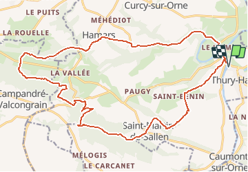

Length
24 km

Max alt
269 m

Uphill gradient
623 m
Km-Effort
32 km

Min alt
23 m

Downhill gradient
624 m
Boucle
Yes
Creation date :
2014-12-10 00:00:00.0
Updated on :
2014-12-10 00:00:00.0
2h10
Difficulty : Difficult

FREE GPS app for hiking
 SityTrail
IGN / Geographical institutes
SityTrail Plus
The world is yours!
About
Trail Mountain bike of 24 km to be discovered at Normandy, Calvados, Le Hom. This trail is proposed by albers.
Description
le départ est brutal, voir méchant... les premiers kilomètres pique un peu. a essayer dans l'autre sens.
Positioning
Country:
France
Region :
Normandy
Department/Province :
Calvados
Municipality :
Le Hom
Location:
Thury-Harcourt
Start:(Dec)
Start:(UTM)
684216 ; 5429217 (30U) N.
Comments